Changes in the navigability of the Arctic Northeast Passage over the past four decades
Under global warming, the Arctic has warmed almost four times faster than the rest of the globe, and the sea-ice extent and thickness have significantly decreased and thinned over the past four decades.
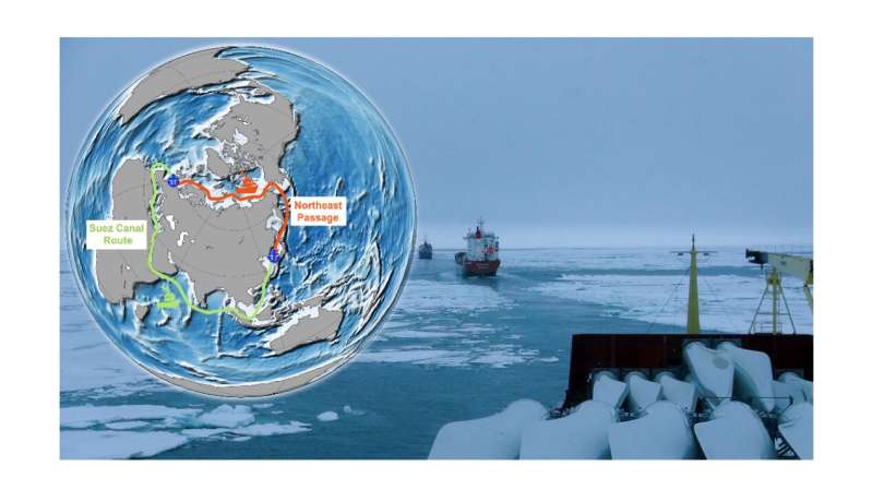
The Northeast Passage (see the orange line in the figure above), which serves as a new conduit for marine trade linking Northeast Asia and Europe, has grown in importance in terms of its scientific value, economic benefits, and geopolitical implications against the backdrop of the rapid changes in Arctic sea ice.
In this respect, assessing the accessibility of this emerging Arctic shipping shortcut is urgently needed. Nevertheless, until now, there have been few attempts to comprehensively evaluate the long-term navigability of the Northeast Passage.
To address this knowledge gap, the daily accessibility of the Northeast Passage from 1979 to 2020 for different types of merchant ships was recently examined by a team led by Prof. Qinghua Yang from Sun Yat-sen University in China, Dr. Yiguo Wang from the Nansen Center for Environment and Remote Sensing in Norway, and Dr. Jinlun Zhang from the University of Washington in the United States. In the study, which was recently published in Advances in Atmospheric Sciences, sea-ice data (both thickness and concentration) were employed to simulate Arctic shipping routes.
The team found that, despite high interannual and interdecadal variability in the Navigable Window (NW) in the Northeast Passage, there was nonetheless a detectable general trend. Specifically, the number of navigable days has been steadily growing, reaching 89±16 days for Open Water (OW) ships and 163±19 days for Polar Class 6 (PC6) ships in the 2010s. In addition, more consecutive NWs have emerged for both OW ships and PC6 ships since 2005 because of the faster sea-ice retreat.
Since the 1980s, according to the simulation, the number of Arctic routes has continuously increased, with optimal navigability found in years of record-low sea-ice extent (e.g., 2012 and 2020). On the other hand, summertime navigability in the East Siberian Sea and Laptev Sea varied dramatically owing to the changes in sea-ice conditions.
It should be noted that governmental policies, geopolitics, and international situations are significant considerations when determining route choices, in addition to factors like ice conditions, weather, and ocean conditions. Furthermore, a scientific topic worthy of future investigation is the impact that increased Arctic maritime activities would have on the environment and climate.
More information:
Chao Min et al, Toward Quantifying the Increasing Accessibility of the Arctic Northeast Passage in the Past Four Decades, Advances in Atmospheric Sciences (2023). DOI: 10.1007/s00376-022-2040-3
Citation:
Changes in the navigability of the Arctic Northeast Passage over the past four decades (2023, February 16)
retrieved 16 February 2023
from https://phys.org/news/2023-02-arctic-northeast-passage-decades.html
This document is subject to copyright. Apart from any fair dealing for the purpose of private study or research, no
part may be reproduced without the written permission. The content is provided for information purposes only.
